ฝนตก ชาร์จได้ตามปกติRain: charge as normal
ตู้ชาร์จ Ultrafast เป็นอุปกรณ์สำหรับติดตั้งกลางแจ้ง ฝนตกตามปกติอยู่ในเงื่อนไขการออกแบบUltrafast chargers are outdoor equipment. Normal rain is part of what they are designed for.
ฝนหนักต่อเนื่อง · ติดตามสด
กำลังโหลด…
Ultrafast-TH · Huawei FusionCharge
ฝนตกชาร์จได้ตามปกติ — ตู้ชาร์จ Ultrafast ออกแบบมาเพื่อติดตั้งกลางแจ้ง แต่น้ำท่วมเป็นอีกเรื่อง ดูสถานีชาร์จในกรุงเทพฯ และปริมณฑล สถานะล่าสุด และถนนรอบสถานีที่มีน้ำท่วมตอนนี้Rain is part of the design — Ultrafast chargers are built for outdoor sites. Flood water is different. See the stations in and around Bangkok, their latest status, and which roads around them are flooded right now.
กำลังโหลด…
—
ฝนเฉลี่ยทั่วกรุงเทพฯ รายชั่วโมง (แบบจำลอง) · เส้นแดง = ตอนนี้
เลื่อนแถบเวลาหรือกด ▶ เพื่อดูฝน 3 วันที่ผ่านมาถึง 5 วันข้างหน้า และน้ำบนถนนจากเซนเซอร์ กทม. ณ จุด “ตอนนี้” แผนที่แสดงเรดาร์และเซนเซอร์สด ส่วนช่วงย้อนหลังและล่วงหน้าเป็นฝนจากแบบจำลองรายชั่วโมง (ไม่ใช่ค่าวัดจริง) · ลากเพื่อเลื่อน ใช้สองนิ้วเพื่อเอียงและหมุนDrag the time bar or press ▶ to run rain from three days back to five days ahead, with water on the roads from BMA sensors. At “now” the map shows the live radar and sensors; before and after, rain is the hourly model estimate (not a measurement). Drag to pan; two fingers to tilt and rotate.
สีของถนนมาจากจุดวัดที่น้ำสูงที่สุดบนถนนนั้น (แดงเข้ม >15 ซม. · แดง 10–15 · ส้ม 5–10) ความยาวเส้นบนแผนที่ลากตามช่วงที่ Google Maps แสดงรถติดหรือปิดถนนต่อเนื่องจากจุดวัด ถ้าไม่มี จะเป็นเส้นสั้นราว 120 ม. — แตะถนนเพื่อดูบนแผนที่ · ข้อมูลและเส้นถนนจากหน้า “เลี่ยงถนนน้ำท่วม กทม.” ของ กทม.Each road takes the colour of its deepest sensor (dark red >15 cm · red 10–15 · amber 5–10). The line follows the stretch Google Maps shows jammed or closed next to the sensor, or a ~120 m stub when it shows nothing. Tap a road to see it on the map. Data and road lines from BMA's “เลี่ยงถนนน้ำท่วม กทม.” page. now.bangkok.go.th ↗
มาจากไฟล์สรุปรายงานของสำนักงานเขต ไม่ใช่เซนเซอร์ — เส้นประสีม่วงบนแผนที่ ระดับ “หนัก” = รถเล็กผ่านไม่ได้ หรือน้ำ ≥25 ซม. ตำแหน่งเทียบจากชื่อถนน จึงเป็นตำแหน่งโดยประมาณFrom the district offices' summary file, not sensors — dashed purple on the map. “Severe” = small cars cannot pass or water ≥25 cm. Positions are matched from road names, so they are approximate.
แต่ละสถานีบอกสถานะล่าสุด และถนนรอบสถานีว่ามีน้ำท่วมหรือไม่ ในกรุงเทพฯ จากเซนเซอร์ถนนและรายชื่อถนนที่ กทม. แนะนำให้เลี่ยง ส่วนในจังหวัดรอบกรุงเทพฯ จากจุดวัดระดับน้ำในคลอง แม่น้ำ และน้ำท่วมถนนของ ThaiWaterEach station shows its latest status and whether the roads around it are flooded — in Bangkok from BMA's road sensors and its list of roads to avoid, and in the provinces around it from ThaiWater's canal, river and road-flood readings.
สถานะเป็นข้อมูลล่าสุดที่มีในขณะนั้น — ยืนยันสถานะและหัวชาร์จที่ว่างในแอปผู้ให้บริการก่อนออกเดินทาง “ไม่มีรายงานน้ำท่วม” ไม่ได้แปลว่าถนนทุกเส้นแห้ง เซนเซอร์ของ กทม. วัดได้เฉพาะบางจุด และจุดวัดของ ThaiWater ในจังหวัดรอบกรุงเทพฯ ยิ่งห่างกันกว่านั้นStatus is the latest available at the time — confirm the station and a free charger in the operator's app before you set off. “No flooding reported” does not mean every road is dry: BMA's sensors cover some points only, and ThaiWater's gauges in the provinces around Bangkok are further apart still.
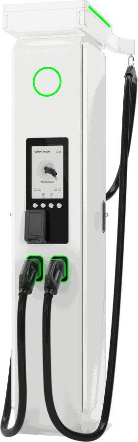
ตู้ชาร์จ Ultrafast เป็นอุปกรณ์สำหรับติดตั้งกลางแจ้ง ฝนตกตามปกติอยู่ในเงื่อนไขการออกแบบUltrafast chargers are outdoor equipment. Normal rain is part of what they are designed for.
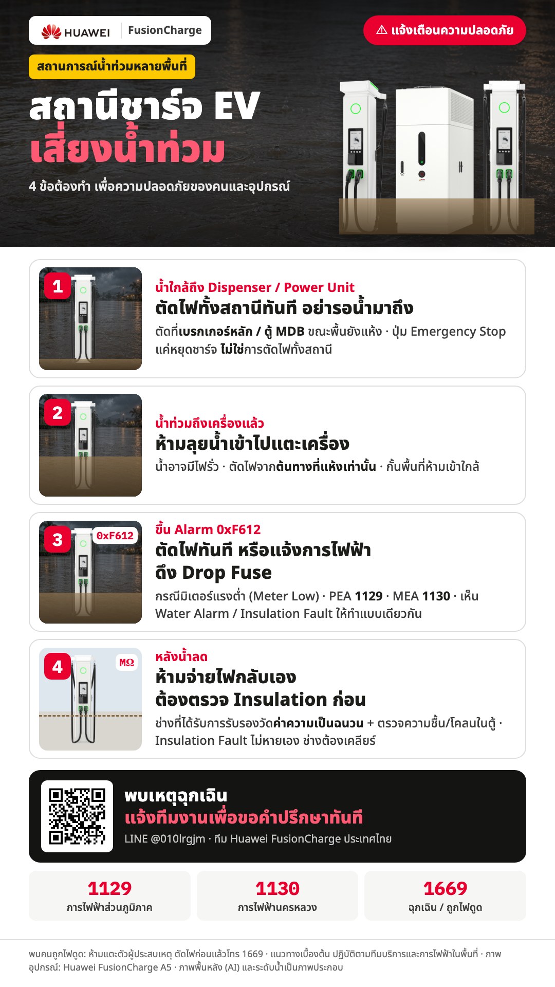
ถ้ามีน้ำขังถึงตู้ชาร์จ สายชาร์จ หรือหัวชาร์จ อย่าเสียบชาร์จ อย่าเดินลุยน้ำเข้าไป และอย่าแตะอุปกรณ์ — น้ำอาจมีไฟรั่วIf standing water reaches the charger, its cables or its guns, don't plug in, don't wade in, and don't touch the equipment — the water may be live.
เลือกสถานีที่ถนนรอบ ๆ ไม่มีรายงานน้ำท่วม และดูรายชื่อถนนที่ กทม. แนะนำให้เลี่ยงในแท็บ “ภาพรวมกรุงเทพฯ” ก่อนออกเดินทางPick a station with no flooding reported around it, and check the roads BMA says to avoid on the “All Bangkok” tab before you set off.
เมื่อน้ำใกล้ถึงสถานี เจ้าของสถานีต้องตัดไฟทั้งสถานีก่อนน้ำมาถึง ถ้าได้รับแจ้งให้หยุดชาร์จและย้ายรถ ให้ถอดสายและออกจากจุดชาร์จทันทีWhen water is coming, the station has to cut its power before it arrives. If you're asked to stop charging and move, unplug and leave the bay straight away.
ปุ่มนี้ไม่ได้ตัดไฟทั้งสถานี อย่าเข้าไปกดถ้ามีน้ำท่วมถึงตู้ — แจ้งเจ้าหน้าที่หรือผู้ให้บริการแทนIt does not cut the station's power. Don't go in to press it if water has reached the unit — tell the staff or the operator instead.
ห้ามแตะตัวผู้ประสบเหตุจนกว่าจะตัดไฟแล้ว จากนั้นโทร 1669Don't touch them until the power is cut. Then call 1669.
แนวทางจากทีม Huawei FusionCharge ประเทศไทย แตะภาพเพื่อดูขนาดเต็มGuidance from the Huawei FusionCharge Thailand team. The cards are in Thai; the four steps are written out in English beside them. Tap a card to enlarge it.
เครื่องชาร์จ Ultrafast ระบบ Power Unit ระบายความร้อนด้วยของเหลว แผนที่สถานีทั่วประเทศ และข้อมูลสำหรับผู้ลงทุนสถานีชาร์จLiquid-cooled Ultrafast chargers, the station map across Thailand, and what a charging-station investor needs to know.
| สถานีGauge | มม./24 ชม.24 h mm | เวลาRead |
|---|
| สถานีStation | ระดับ ม.Level m | ถึงตลิ่งTo bank |
|---|
เซนเซอร์น้ำท่วมถนนของสำนักการระบายน้ำ กทม. อัปเดตทุก 10 นาที นับเฉพาะเซนเซอร์ที่รายงานภายใน 3 ชั่วโมง และไม่นับจุดที่ กทม. ระบุว่าขัดข้อง ถนนที่ไม่มีเซนเซอร์หรือเซนเซอร์ขัดข้องไม่ได้แปลว่าแห้ง
จากหน้า “เลี่ยงถนนน้ำท่วม กทม.” (now.bangkok.go.th) และรายงานของสำนักงานเขต ดึงข้อมูลทุก 10 นาที
ฝนบนแผนที่มาจาก Open-Meteo (best_match) กริด 9×9 จุดครอบคลุมกรุงเทพฯ อัปเดตทุกชั่วโมง เป็นค่าจากแบบจำลอง ไม่ใช่ค่าวัดจริง ค่าฝนของเวลา HH:00 คือฝนในชั่วโมงก่อนหน้า ณ จุด “ตอนนี้” แผนที่ใช้เรดาร์ RainViewer ที่วัดได้จริงแทน น้ำบนถนนย้อนหลังบันทึกจากเซนเซอร์ กทม. ทุก 10 นาที
สรุปโดย AI (Opus 5.5) วันละ 4 รอบ ผ่านการตรวจสอบข้อเท็จจริงอีกรอบก่อนเผยแพร่ ใช้เป็นข้อมูลประกอบ ไม่ใช่ประกาศทางการ
รายชื่อและตำแหน่งสถานีมาจากแผนที่สถานีของ FusionCharge Wiki “ถนนรอบสถานี” ดูเซนเซอร์ถนน กทม. ที่รายงานภายใน 3 ชั่วโมงในรัศมีราว 2.5 กม. และถนนน้ำท่วมจากรายชื่อของ กทม. ในรัศมีราว 1.5 กม. นอกกรุงเทพฯ (และจุดที่ไม่มีเซนเซอร์ กทม. ใกล้) ใช้ข้อมูล ThaiWater: เซนเซอร์น้ำท่วมถนนในรัศมีราว 1.5 กม. ส่วนระดับน้ำในคลองหรือแม่น้ำในรัศมีราว 2 กม. แสดงเป็นข้อมูลประกอบเท่านั้น เพราะจุดวัดที่ประตูระบายน้ำขึ้นถึงตลิ่งได้ตอนน้ำทะเลหนุนแม้ถนนไม่มีน้ำท่วม สถานะสถานีเป็นข้อมูลล่าสุดที่มี — ยืนยันในแอปผู้ให้บริการก่อนเดินทางเสมอ
ระดับน้ำในคลองและแม่น้ำ ฝนสะสม 24 ชม. และจุดน้ำท่วมถนน ใน 6 จังหวัดรอบกรุงเทพฯ จากคลังข้อมูลน้ำแห่งชาติ (ThaiWater) ไม่แสดงค่าที่เก่ากว่า 6 ชั่วโมง (ฝน 26 ชั่วโมง) และถ้าข้อมูลทั้งชุดไม่ได้อัปเดตเกิน 90 นาที ชั้นข้อมูลนี้จะหายไปเอง
BMA Drainage Department road-flood sensors, refreshed every 10 minutes. Only sensors that reported within 3 hours count, and none that BMA marks out of order. A road with no sensor, or a broken one, is not a dry road.
From BMA's “เลี่ยงถนนน้ำท่วม กทม.” page (now.bangkok.go.th) and the district offices' report, fetched every 10 minutes.
Map rain is Open-Meteo (best_match) on a 9×9 grid over Bangkok, refreshed hourly — a model estimate, not a measurement. The value at HH:00 is the rain of the hour before. At “now” the map shows the observed RainViewer radar instead. Past road water is recorded from BMA sensors every 10 minutes.
Written by an AI analyst (Opus 5.5) four times a day, with a separate fact-check pass before it is published. Treat it as context, not an official notice.
Station names and positions come from the FusionCharge Wiki station map. “Roads around the station” looks at BMA road sensors that reported within 3 hours, about 2.5 km around it, and at BMA's flooded-road list within about 1.5 km. Outside Bangkok (or where no BMA sensor is near) it uses ThaiWater road-flood sensors within about 1.5 km; canal and river levels within about 2 km are shown as context only, because tide-gate gauges reach their bank at high tide even when the roads are dry. Station status is the latest available — always confirm in the operator's app before you go.
Canal and river levels, 24-hour rain and road-flood points in the six provinces around Bangkok, from the National Hydroinformatics Data Center (ThaiWater). Readings older than 6 hours (rain: 26 hours) are not shown, and if the whole feed has not updated for 90 minutes the layer disappears.